
Rain feels like the simplest thing in the world. Water falls out of the sky, you reach for an umbrella, done. But the path a single drop takes to reach your head is a small marvel of physics, with at least one step almost nobody knows about. Why does it rain at all? The real answer starts not in the clouds, but at the surface, with sunlight.
The short answer: a round trip for water
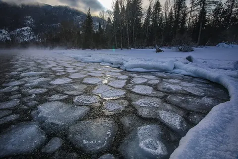
Rain is the visible end of the water cycle. The sun heats oceans, lakes, and damp ground, and water evaporates into the air as invisible vapor and rises. Higher up the air is thinner and colder, and as the vapor cools it condenses back into liquid. Those droplets gather into clouds, grow, and eventually fall. The whole thing is water taking a trip up and coming back down.
Why a cloud needs a speck of dust
Here is the part that surprises people. Water vapor cannot simply turn back into droplets in clean air. It needs something to cling to first. As NOAA puts it, "the water vapor must have a solid to glom onto," and that solid seed "may be a speck of dust or pollen, or a drop of water or crystal of ice" (NOAA).
So every cloud is built on dirt. Floating particles of dust, sea salt, and smoke act as tiny anchors, and water condenses around each one into a microscopic droplet. Millions of those droplets hanging together are what you see as a cloud. (And no, a cloud is not made of vapor. Vapor is invisible. A cloud is already liquid.)
From droplet to downpour
A cloud droplet is far too small to fall. It would be held up by the gentlest rising air, and on its own it would just drift. To become rain, it has to grow, and a lot.
In warmer clouds, droplets grow by bumping into one another and merging, a process called collision-coalescence. In colder clouds, a faster route takes over: ice crystals grow quickly, then melt into rain as they drop into warmer air below. Either way, the scale is staggering. According to the USGS, "millions of cloud droplets are required to produce a single raindrop" (USGS).
A drop only falls once it wins a tug-of-war with the cloud's updraft. As the USGS explains it, when collisions build "a droplet with a fall velocity which exceeds the cloud updraft speed, then it will fall out of the cloud as precipitation." Heavy enough to beat the wind holding it up, and down it comes.
The shape you were taught is wrong
One last myth to wash away. The pointed teardrop shape on every weather forecast and umbrella logo is not what a raindrop looks like. Small drops are round, pulled into spheres by surface tension. As a drop falls faster and grows, the air rushing up against its underside flattens the bottom, so a big raindrop ends up shaped "more like that of a hamburger bun" (USGS). Push past a radius of about 4.5 millimeters and the drop distorts so badly it splits in two.
The same atmosphere that builds and drops your rain also bends sunlight into color overhead, which is the story behind why the sky is blue.
Keep wondering: rain is one chapter of water's strange behavior, alongside the quirk that makes ice float and the sheer scale of where all that water ends up, in how deep the ocean goes. More at The Science of Us.


Join the conversation
Comments are reviewed before they appear. Be kind and stay curious.
Loading comments…